smart-cities
Explore Our Smart Cities Solutions
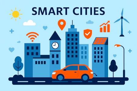
Smart Cities
VR • AR • MR in Smart Cities
Immersive technologies powering planning, operations, services, and citizen engagement for future-ready cities.
VR in Smart Cities
Building the Future with Virtual Reality
Virtual Reality (VR) is becoming a powerful tool in designing, managing, and experiencing Smart Cities. From urban planning to citizen engagement, VR helps visualize and interact with environments like never before.
How VR Supports Smart Cities
Urban Planning & Visualization
Walk through 3D city models pre-construction to spot challenges and make better decisions.
Citizen Engagement
Residents explore projects, spaces, and transport virtually and give feedback.
Training & Simulation
Train responders, maintenance crews, and public service teams safely.
Smart Infrastructure Management
See utilities, traffic, and assets via immersive real-time data.
Tourism & Culture
Virtual tours, historical recreations, and digital twins for engagement.
Inclusive Design
Simulate perspectives of differently-abled citizens to ensure accessibility.
Benefits of Using VR in Smart Cities
Better Decision-Making
Visual context speeds smarter choices.
Cost Savings
Catch design flaws early and reduce rework.
Enhanced Public Trust
Transparent, interactive presentations build support.
Sustainability
Model environmental impacts and design greener cities.
Efficiency
Optimize maintenance, emergency response, and services.
Key Applications
- Virtual Urban Master Planning
- Smart Building Management
- Public Transport System Simulations
- VR-Based Disaster Response Training
- Virtual Heritage & Smart Tourism
- Digital Twins for City Operations
Urban Master Planning
Transport Simulations
Disaster Response Training
City Digital Twin
AR in Smart Cities
Augmented Reality: Enhancing Urban Life
Overlay navigation, data, services, and experiences onto the real world to make cities more interactive, efficient, and citizen-friendly.
How AR Powers Smart Cities
Smart Navigation & Wayfinding
Real-time directions, transit info, and landmarks overlaid in view.
Infrastructure Monitoring
Visualize underground utilities and structural data without digging.
Citizen Services & Engagement
Report issues or explore projects by pointing a phone at a site.
Retail & Commerce Enhancement
Interactive storefronts and personalized, location-aware offers.
Tourism & Cultural Experiences
Dynamic tours of historic sites, art, and stories.
Emergency Response & Training
Access layouts, routes, and live data during incidents.
Benefits of Using AR in Smart Cities
Increases Accessibility
Real-time info simplifies navigation and services.
Enhances Public Safety
Early issue detection and safer public spaces.
Boosts Economic Growth
AR retail, tourism, and services create new revenue.
Drives Sustainability
Less signage/printing; greener communications.
Promotes Engagement
Interactive, participatory platforms for citizens.
Key Applications
- AR Smart Navigation Apps
- Infrastructure Inspection & Repair
- Smart Retail & AR Advertising
- Interactive City Tours & Museums
- Public Safety & Disaster Management
- Smart Governance & Citizen Reporting
AR Wayfinding
Utility Visualization
Citizen Reporting
Smart Retail
MR in Smart Cities
Mixed Reality: Building Smarter, More Connected Cities
Blend the physical and digital for real-time interaction, collaborative planning, and smarter operations.
How MR Supports Smart Cities
Urban Planning & Design
Full-scale models for real-time collaboration and choices.
Smart Infrastructure Management
See inside walls and pipelines to find issues without disruption.
Public Safety & Emergency Response
Interiors, routes, and hazards visualized in real time.
Citizen Engagement & Participation
Interactive MR experiences for projects and zoning.
Workforce Training & Simulation
Realistic MR for traffic, transit, and maintenance teams.
Smart Tourism & Cultural Experiences
Landmarks and spaces become interactive venues.
Benefits of Using MR in Smart Cities
Better Decision-Making
High spatial accuracy and context.
Increased Operational Efficiency
Guided tasks reduce errors and downtime.
Enhanced Public Engagement
Plans come to life to build trust.
Cost Savings
Catch design/infrastructure issues early.
Boosted Safety
Situational awareness for quicker response.
Key Applications
- Mixed Reality Urban Planning
- MR for Smart Utilities & Infrastructure
- Emergency Simulation & Public Safety
- Interactive Smart City Projects
- Workforce MR Training Programs
- MR for Smart Tourism & Promotion
MR Urban Planning
MR Utilities Ops
MR Emergency Sim
Citizen MR Portal
Bring VR • AR • MR to Your Smart City
Let’s scope a pilot that accelerates planning, boosts safety, and improves services.
Tags :